Discover Cheshire
Tarporley
Discover Tarporley: A Charming Cheshire Village
Nestled in picturesque countryside, Tarporley is one of Cheshire’s most attractive villages. Just 11 miles from Chester and 10 miles from Nantwich, this charming rural destination offers a blend of rich history, beautiful landscapes, and a welcoming community.
Whether you're strolling through the historic high street or exploring the surrounding countryside, Tarporley exudes a timeless charm.
Tarporley’s origins date back to prehistoric times, with its first recorded mention in the Domesday Book of 1086 as “Toepelei”, thought to mean “a pear wood near a hill” in Old English. This historic reference is still celebrated today, with Tarporley Church of England Primary School proudly featuring a pear tree in its emblem.
In 1066, Tarporley was owned by Wulfgeat of Madeley and valued at £1. By 1086, under new ownership by Gilbert the Hunter, its value had fallen to £0.50. You can explore the village’s fascinating Domesday Book entry here.
From its historic architecture to its quaint shops, cosy pubs, and scenic countryside, Tarporley offers an inviting escape for visitors. Whether you're discovering local heritage or enjoying a leisurely walk through rolling landscapes, this quintessential Cheshire village is not to be missed.

Experiences in Tarporley
Budget:

Fetching your results
This should only take a few moments...
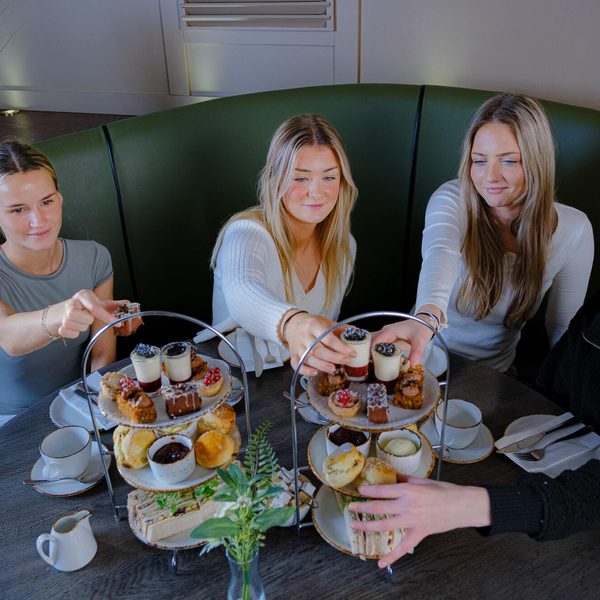
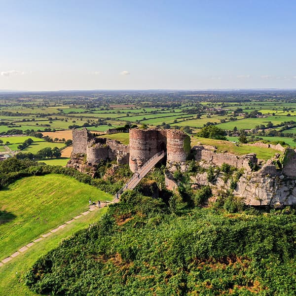
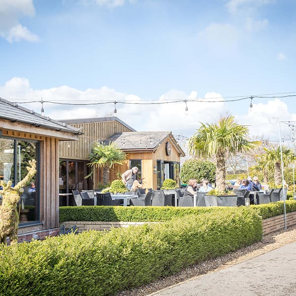
Afternoon Tea at Peckforton Castle
Afternoon tea is a well-known and loved English tradition and nowhere offers a more extravagant experience than our 2010 Brasserie.
£29.00 From price per person
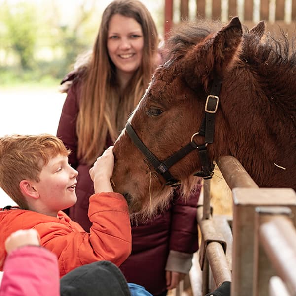
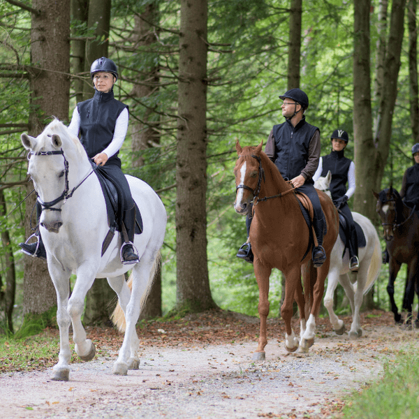
Shire Horse Experience
Enjoy a wonderful day getting up close and personal with some of the biggest horses in the world!
£100.00 From price per person
Unmissable Events in Tarporley
Fetching your results
This should only take a few moments...

60's Music Open Mic Night
Dates: 19th Jun
60s Open Mic Night at Tilly's Bunbury. Step back in time and join us for a groovy evening of live music, great company and classic 60s vibes

Wet Felting Workshop – Northern Lights & Sunsets
Dates: 26th Jun
An atmospheric wet felting workshop inspired by sunsets & the northern lights.
Trails in Tarporley
Fetching your results
This should only take a few moments...
5 Miles
Owned by the Tarvin Community Woodlands Trust to conserve, restore and re-establish native trees, plants and all types of wildlife, this delightful 5ha site allows a short walk through open woodland, meadow and wildflower areas.
Bishop Bennet Way
34 Miles
The Bishop Bennet Way runs from below Beeston Castle, west towards the Welsh border, passing by Tattenhall and Aldford before turning south and east past Farndon towards Malpas and Whitchurch.
4 Miles
A fascinating circuit exploring prehistoric Beeston, the Peckforton Hills and Peckforton Mere

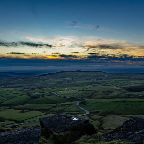
Raw Head Walk
5.5 Miles
Rugged sandstone outcrops, lofty trees and panoramic views both east and west across a patchwork landscape, combine to create an invigorating walk.
Businesses in Tarporley
Fetching your results
This should only take a few moments...
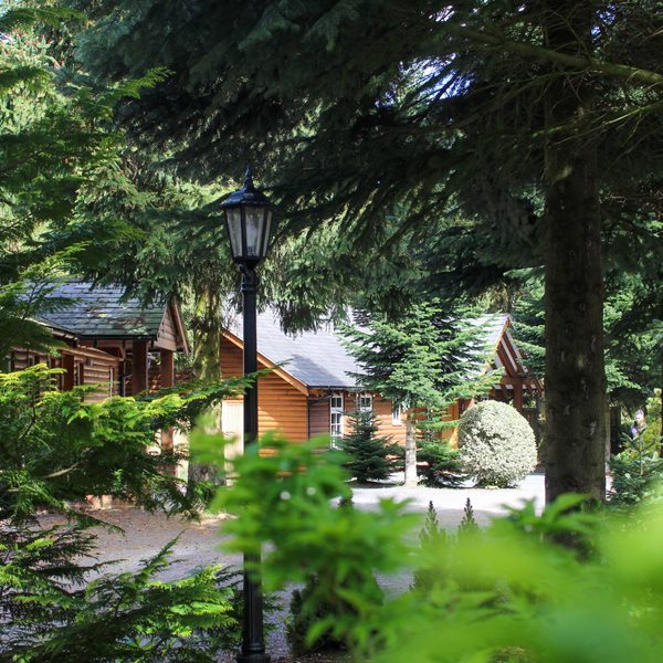
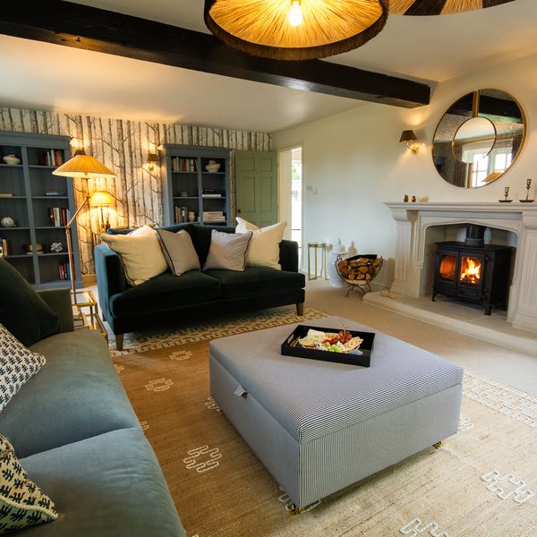
The Hollies Forest Lodges
Nestled in the heart of the Cheshire countryside, you will discover The Hollies Forest Lodges at Little Budworth.
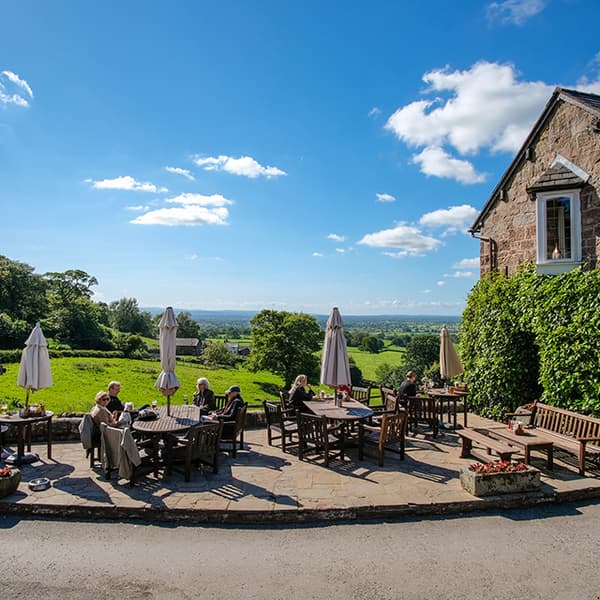
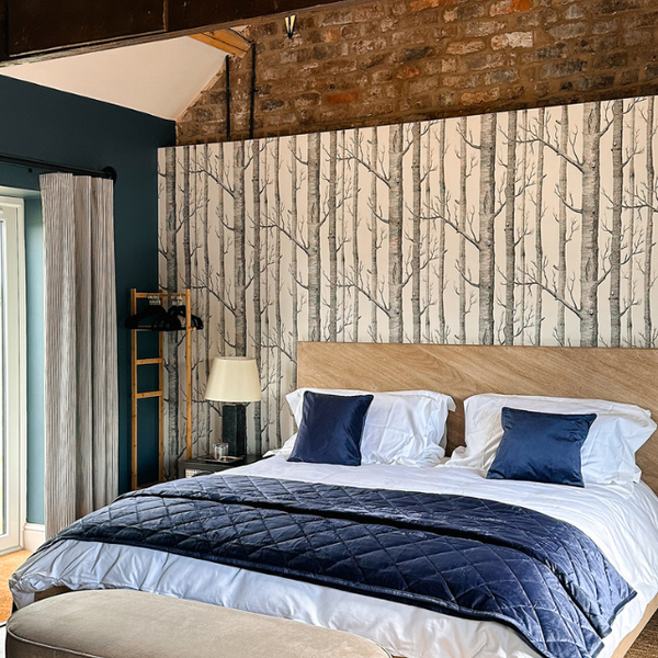
The Pheasant Inn
The Pheasant Inn is an award -winning country inn tucked in a peaceful corner of rural Cheshire, part of the family -run Nelson Hotels & Inns group, and featuring charming countryside accommodation and an AA Rosette awarded restaurant.
Sandstone 34
Escape to Sandstone 34, a charming holiday cottage in the elevated village of Burwardsley.
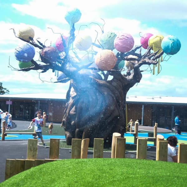
The Ice Cream Farm
Set in the picturesque Cheshire countryside between Beeston and Peckforton Castles, The Ice Cream Farm is the tastiest trip you will ever take, enticing hundreds and thousands of visitors every year!
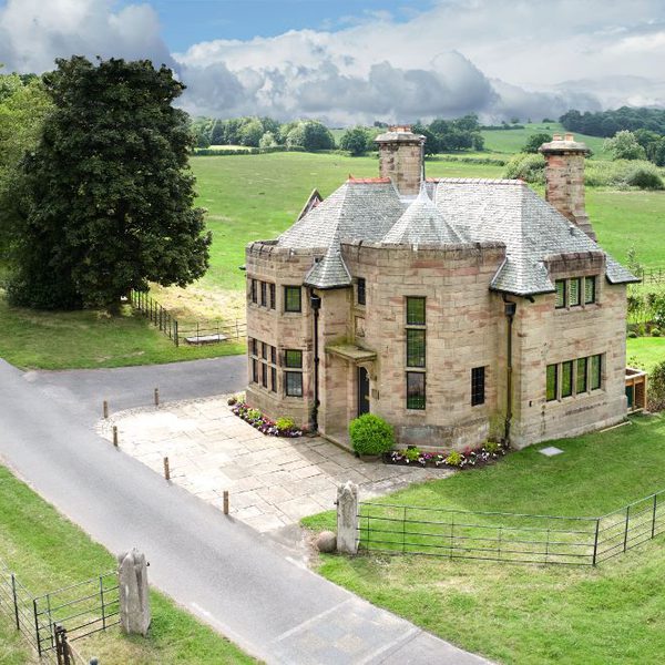
Liongate Lodge
Liongate Lodge is an exclusive one-bedroom retreat nestled within the private grounds of Bolesworth Castle.
Bolesworth Bothy
Liongate Lodge is an exclusive one-bedroom retreat nestled within the private grounds of Bolesworth Castle.
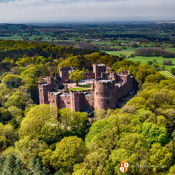
Peckforton Castle
Peckforton Castle is a Grade 1 listed hotel in Cheshire that effortlessly combines the grandeur of medieval architecture with the comfort of modern luxury.
Open daily from 8am The Hollies Takeaway at Little Budworth offers breakfast, brunch, lunch, sweet treats, great coffee by local roasters Lost Barn Coffee, and more!
Offers in Tarporley
Fetching your results
This should only take a few moments...

Expiry Date: 31st Dec 2026
Enjoy unlimited free visits and more!

Expiry Date: 1st Sept 2026
The Great British Summer Savings scheme has been created to help families enjoy more affordable days out this summer.
Expiry Date: 31st Dec 2026
Enjoy unlimited access to hundreds of historic sites with an annual membership. Plus free entry for up to six children*

Expiry Date: 25th Dec 2026
Families save 15% on Treetop Challenge
Articles in Tarporley

Post Date: 22nd May 2026
Read More
Post Date: 17th Apr 2026
Read More
Post Date: 23rd Jan 2026
Read More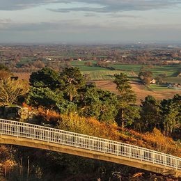
Post Date: 25th Sept 2025
Read More